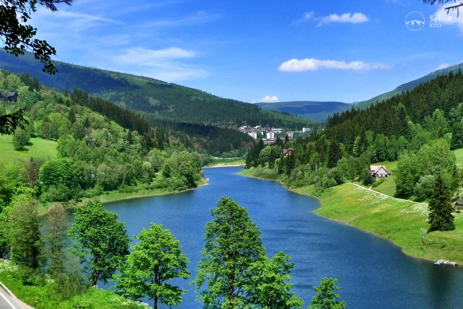
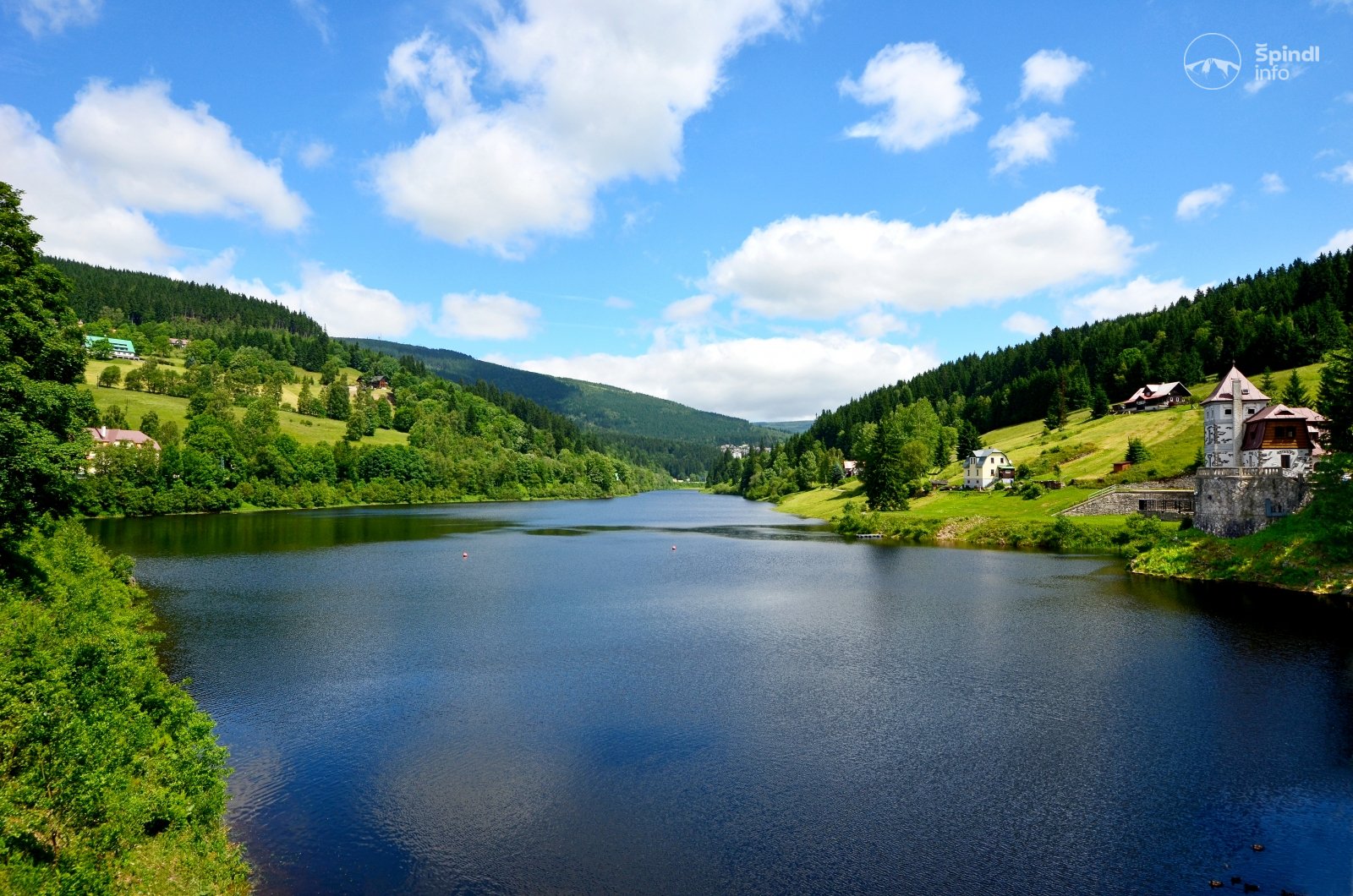
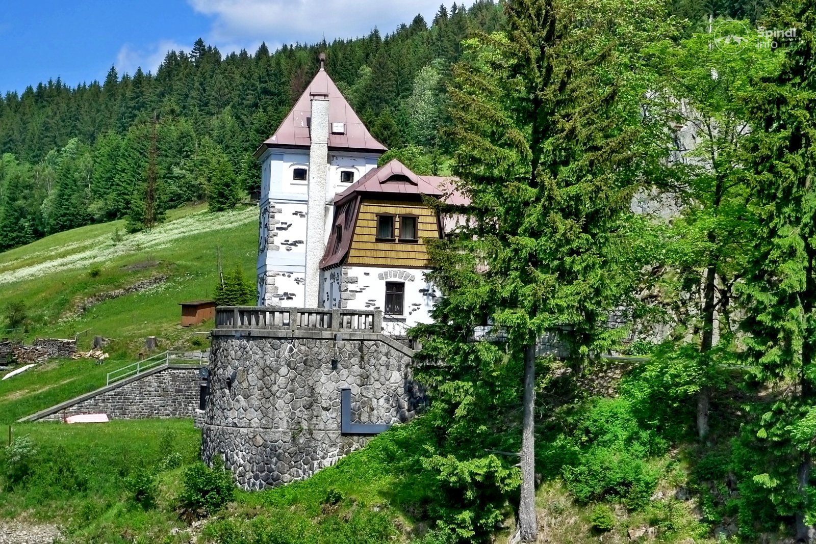
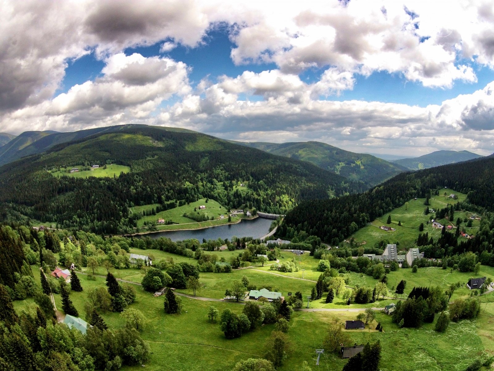
When you arrive in Špindlerův Mlýn, you must not miss this beautiful older elegant lady - the first dam on the Elbe - the Labská dam. We heartily recommend her to visit her.
Trip to the Elbe dam - Špindlerův Mlýn
Trip description:
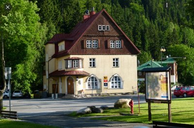
Špindlerovské náměstí - Infocentrum SPINDL.info, you will go 90 m in the direction of Svatý Petr, over a small bridge and before the ČEská hospoda turn right again. At the Czech pub, take a forest path in the direction of the Alpina Hotel, the Fontana Pension and the Labská Reservoir.
It is only 2.5 km from the square to the Elbe Dam. You can walk there in 45 minutes. You can return along the same route.
We will offer you an alternative for the return trip to Špindlerův Mlýn: at the dam you will cross the road in the direction of Špindlerův Mlýn and walk along the other bank of the Elbe dam - see the map preview HERE in the total length of 7 km.
The elevation and map below present the route: Špindlerův Mlýn → Czech pub → Pension Fontana → Labská dam
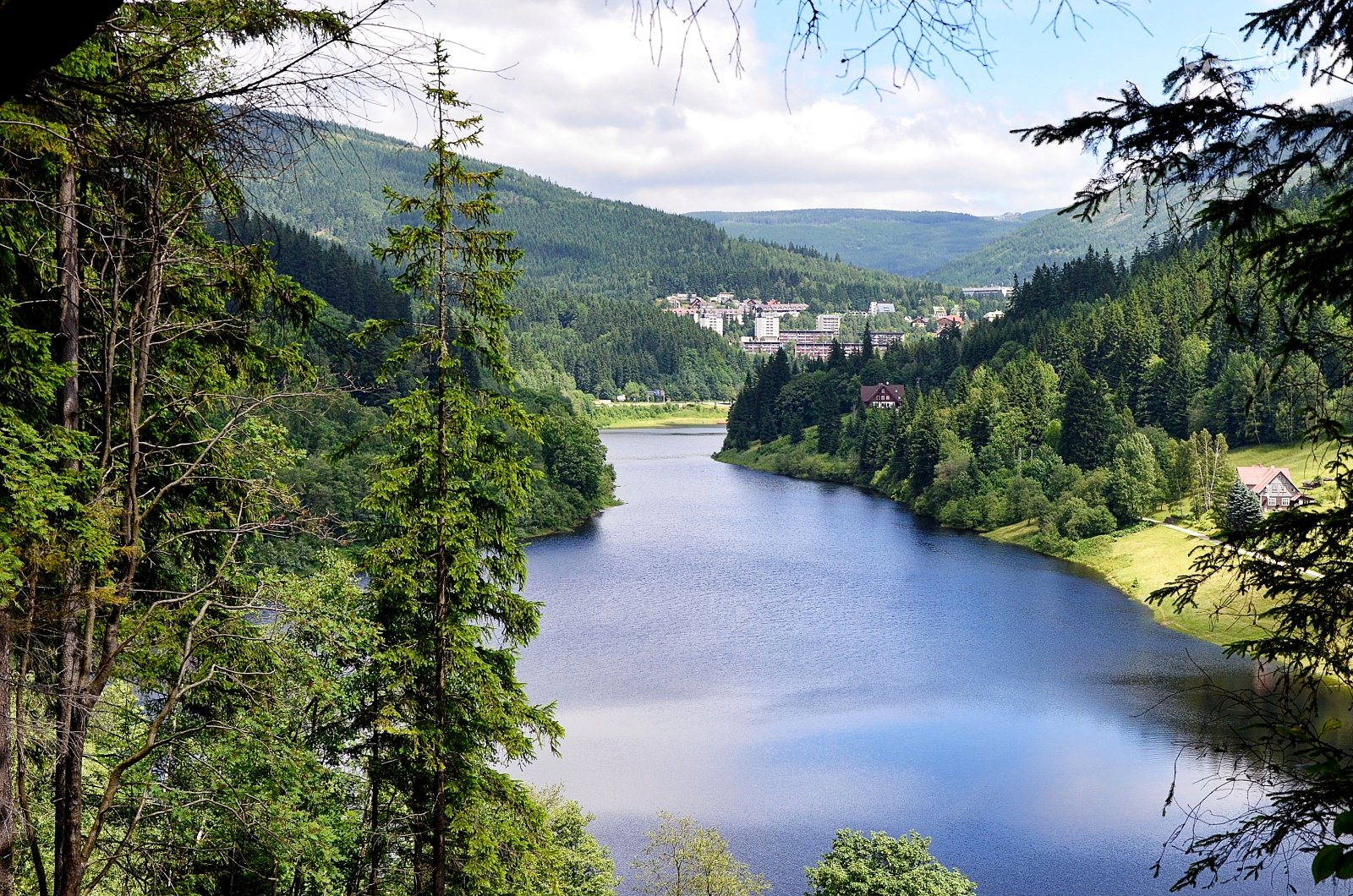
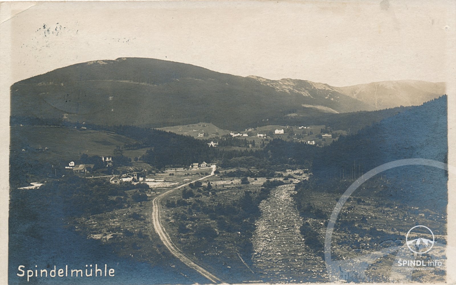
From the center of Špindlerův Mlýn to the dam, a beautiful forest path leads along green tourist markings in the length of about 2.5 km. From the center you go about 100m in the direction of Svaty Petr. After the Information Center, turn right over the bridge. Follow the green direction Hotel Alpina and then Labská. After about 1 km you are at the Hotel Alpina, where you can treat yourself to a short snack on the quiet terrace. After a 700m walk through the woods, a view awaits you at Pension Fontana. There is still a 900m quiet walking path in front of you and you are on the Elbe dam.
You can go back the same way, or along the main road in the direction of Špindlerův Mlýn - from the dam to the right - back to Špindlerův Mlýn.
For safety reasons, however, we would rather advise you on the route through Jelenní dol - link here.
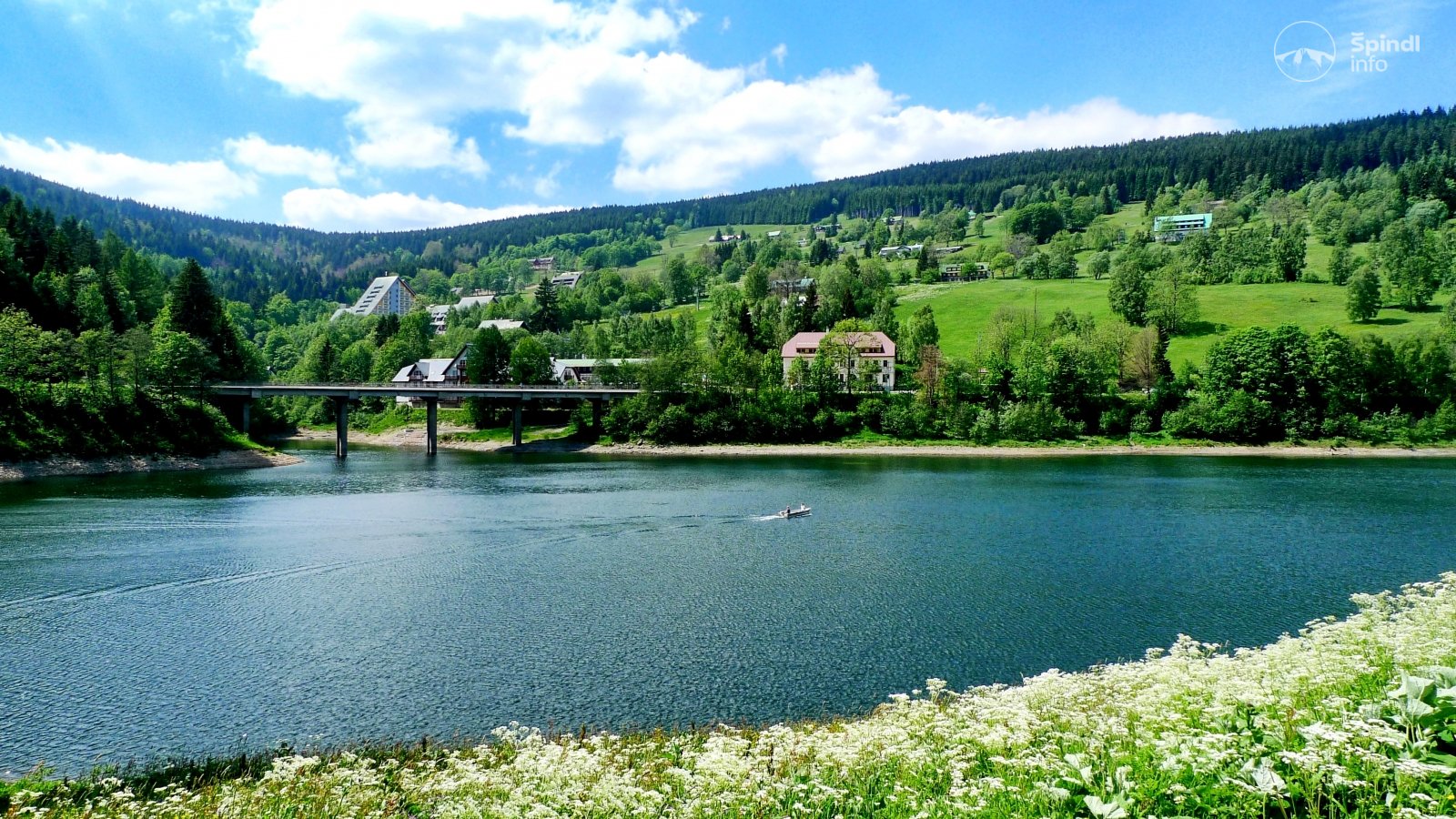
On the way back you can also use the bus - timetable HERE - the stop is 300m from the dam. You can also park your car at the dam.
There is a possibility of swimming in the dam, but without any facilities. Due to the cold mountain water, only real hardy people can come for a swim. In the summer, however, it really refreshes.
However, you can indulge in a little adrenaline by bridging at the dam after bridging it. Fishing is also allowed in the Elbe Dam. Sport fishing on the Elbe Dam is permitted by the Forest Administration of Špindlerův Mlýn - Mr. Pavlík tel. +420 603 900 792 - info and contact HERE. The price of a one-day permit is CZK 400.
ROUTE DESCRIPTION:
Total length of the route - about 4 km on foot (hike in the total length of about 2 hours)
Difficulty: 1/5 - the whole route leads along quality roads.
Baby stroller: YES Also suitable for families with children, possibility with a stroller, bus can be combined.
Refreshments - Pension Fontana, Hotel Clarion
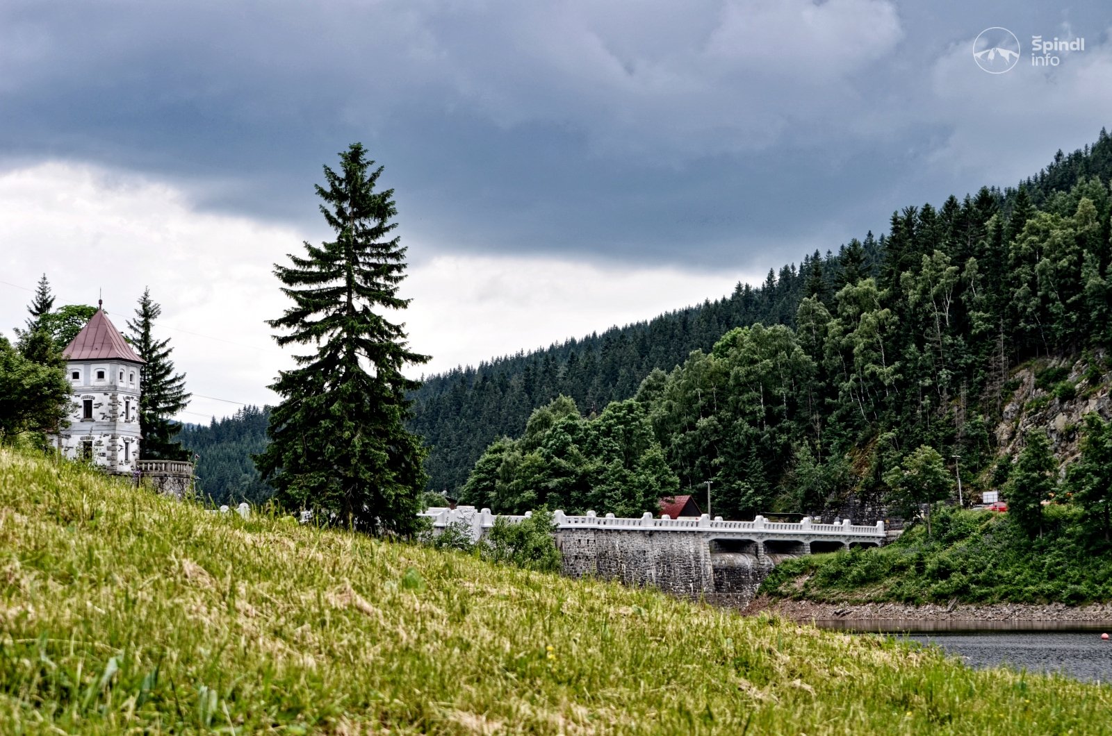
Points of interest on the route - Labská dam, Bridging of the dam,
GPS: 50.7117542N, 15.5838964E
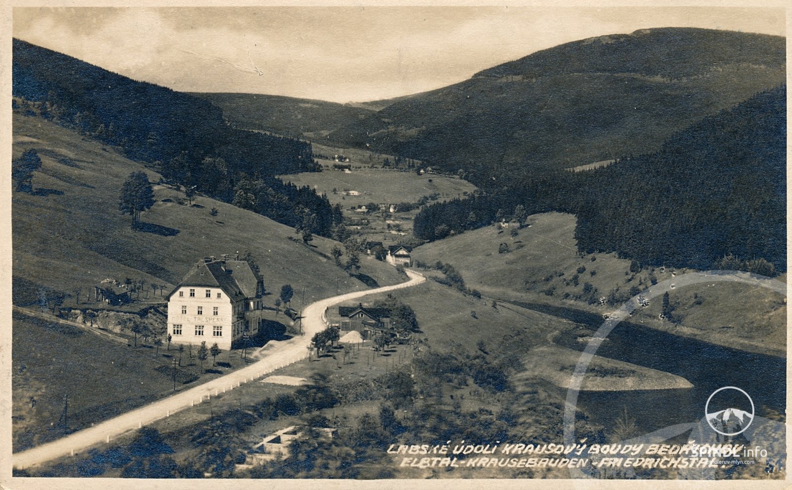
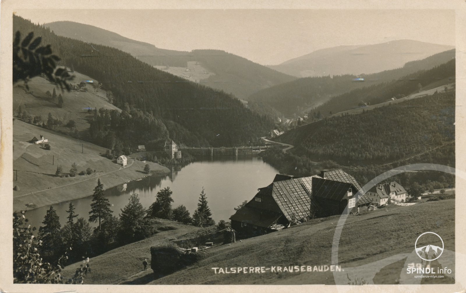
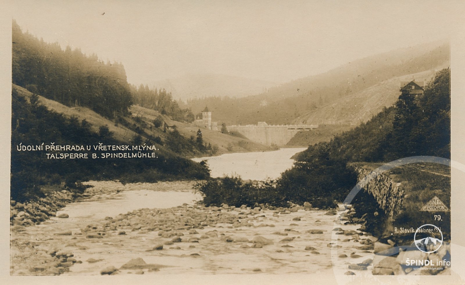
... you can't miss and miss this beautiful older elegant lady when you arrive in Špindlerův Mlýn - the first dam on the river Elbe - the Labská dam - formerly the Krausova Bouda dam.
We heartily recommend her to visit and hike from the center of Spindleruv Mlyn and back for a total of two hours (there and back). This route can also be completed with a pram or with small children. The route to this technical monument and at the same time the idea for an undemanding trip are described below.
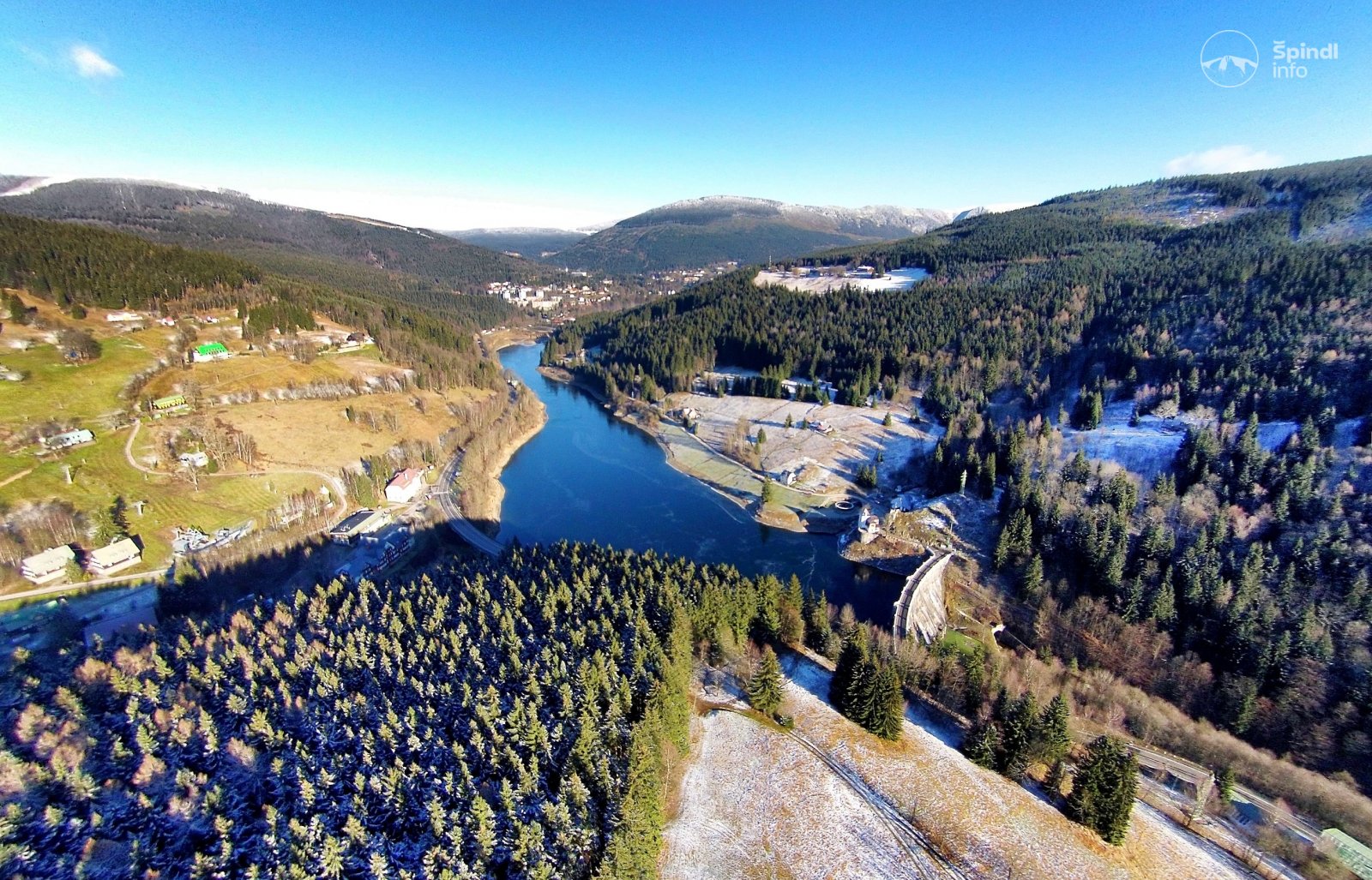
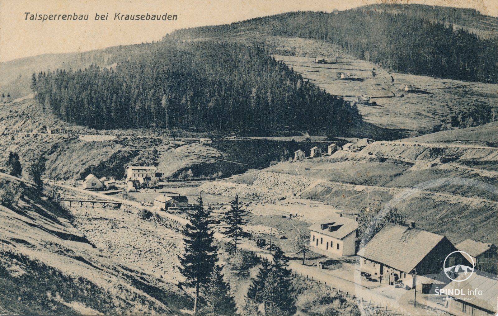
The impetus for the construction of this beautiful work was the floods, which caused catastrophic damage at the end of the 19th century, in the Giant Mountains, especially in 1897. The main purpose of this work is to reduce the passage of large waters and protect the area under the dam. 86.11 m3.) For other uses, it is used, for example, to reduce the flow of the Elbe during the melting of snow.
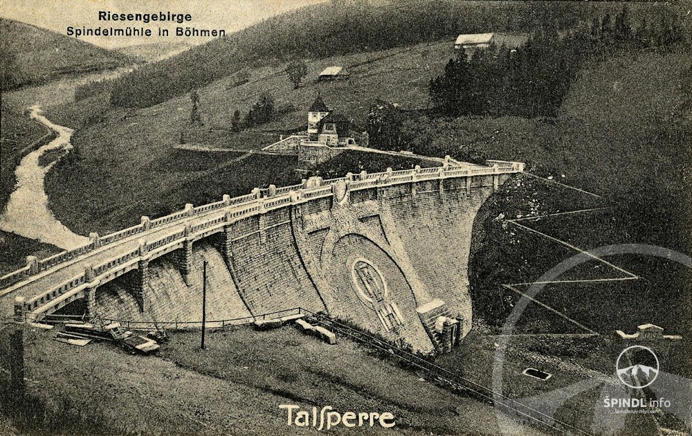
HISTORY OF THE LABSKÁ DAM IN ŠPINDLEROVÝ MLÝN
The year is 1910 and the Viennese company Redlich and Berger began the construction of the Elbe Dam at a cost of 3.5 million Austrian crowns from the fund of the former Provincial Commission for River Treatment in the Czech Kingdom according to a project prepared by the Technical Department for River Treatment and led by Josef Plicky. The construction was completed in 1916. However, approval did not take place until 18.10. 1918. After commissioning, the leaks of dams began to appear, which gradually increased. The project for sealing the dam developed in the 1930s was not implemented on the basis of an expert opinion. Sealing was carried out only as part of the overhaul of this waterworks in the years 1966 - 1986, when, in addition to grouting, the gate valves were also replaced, including the drive, and a number of other repair works.
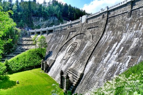
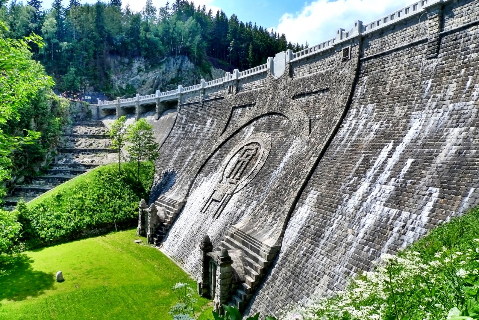
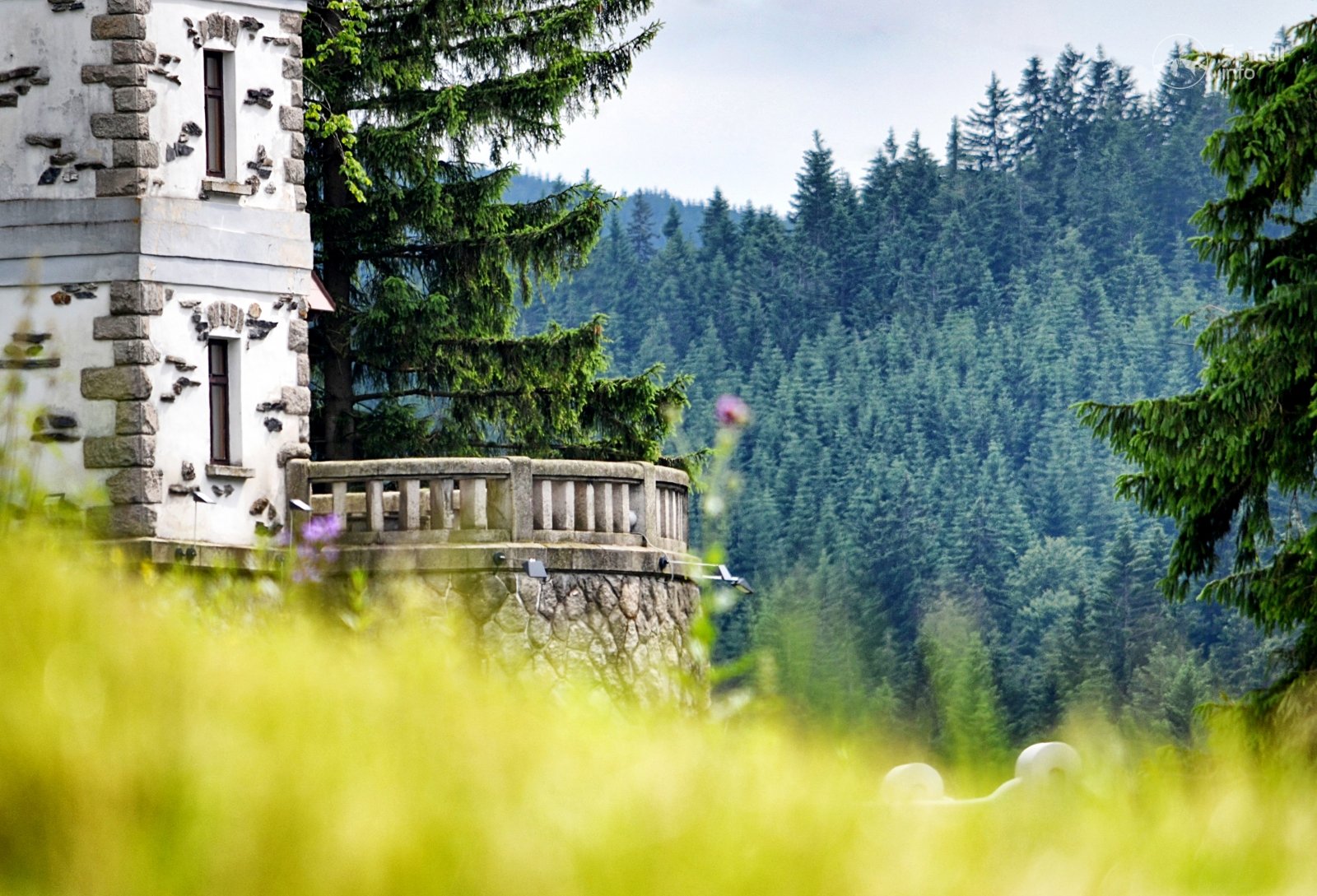
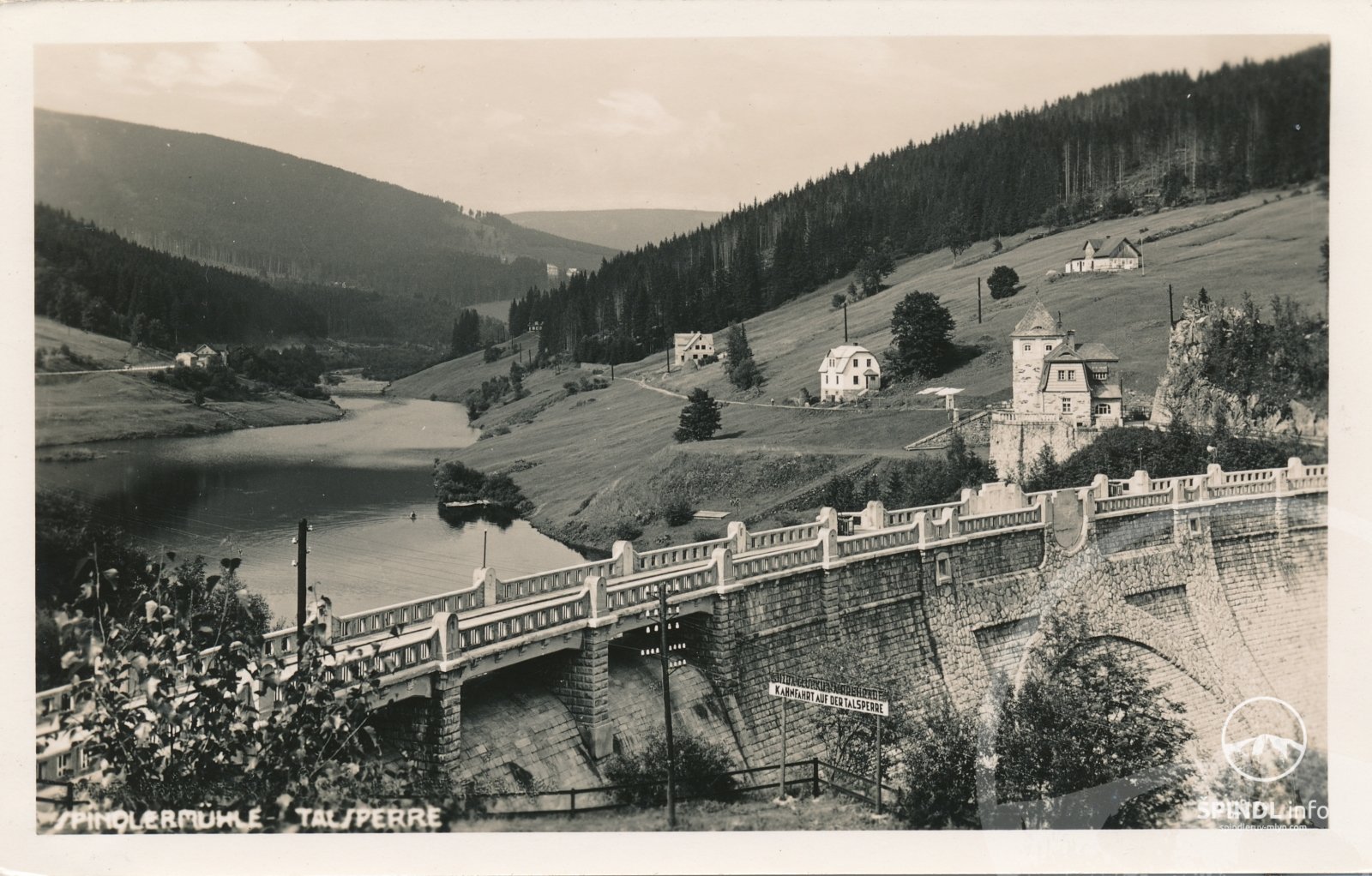
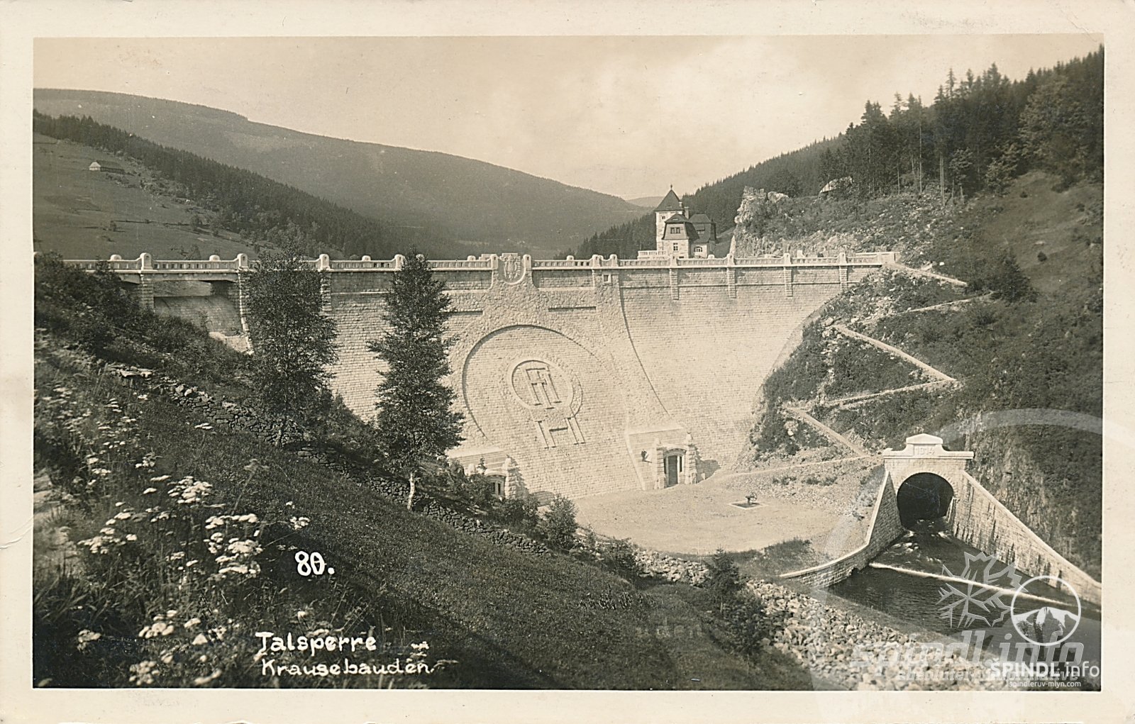
In the middle of the air collar are the initials RČ as a symbol of the Czechoslovak Republic instead of the original initials of the Austrian monarch František Josef I., which were stonemasonly modified to their current form in 1926 after the above-mentioned double-headed Austrian eagle was concreted in 1920.
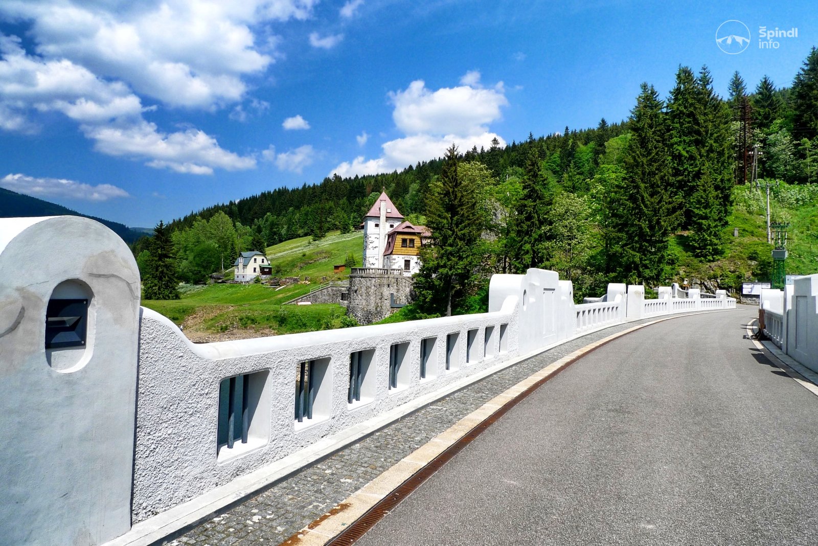
In the years 2006 - 2007, the dam underwent further reconstruction. The repair of the crown of the dam contributed to the perfection.
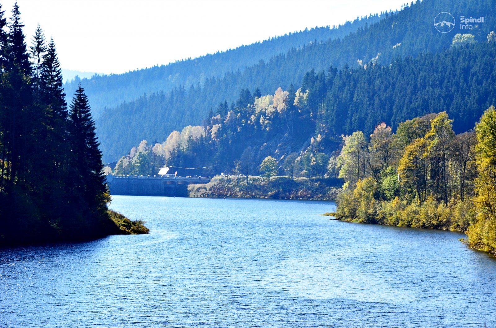
This dam is located at an altitude of 694.16 m above sea level. The dam is based on orthorules at a depth of 4-7 m below the ground surface. The foundation of the right-bank dam overflow and cascades is up to 16 m below the surface.
The heavy arched brick dam of the Intze type with a pre-back is made of local gneiss stone for trasocement mortar.
The maximum height of the dam crown above the base joint is 41.5 m. The length of the dam in the crown is 153.5 m and the width of the dam in the crown is 6.15 m.
The total volume of the reservoir is 3.292 million m3 and the maximum flooded area is 26.78 ha. The average long-term annual flow is 2.14 m3.s-1. The flow of Q100 is 175 m3.s-1.
The left foundation outlet (the right foundation outlet is concreted at the inlet) with a diameter of 1100 mm and a capacity of 11.6 m3.s-1 is used for draining water from the tank. There are also five outlets opening into a bypass tunnel with a diameter of 1000 mm and a total capacity of 89.9 m3.s-1. In 1998, all closures were repaired and the control and actuator were replaced. The bypass tunnel belongs to the main functional objects of the waterworks. The total length of the tunnel is 149.35 m and the dimensions of the horseshoe profile are 7000/7000 mm. The tunnel is broken in a simple rock, only in a short section near the portal it is surrounded by gneiss stone. The safety device for the transfer of large waters is the crown and shaft overflow. The crown overflow is situat the right side of the dam. The overflow crowns are lined with granite blocks. The four overflow fields have a clear width of 9.90 m at the level of the overflow edge. The capacity of all fields is 74.12 m3.s-1. The manhole overflow situated on the left bank of the reservoir behind the dam house is made of quarry stone. The inner diameter at the level of the overflow edge is 11,500 mm. It is equipped with a sieve wall and a service bridge. The circular vertical waste shaft has a diameter of 5000 mm and opens into a bypass tunnel. The capacity of the shaft overflow is 79.37 m3.s-1.
Two limnographic stations are used to monitor the flows above and below the tank. Both are part of the CHMI network with local registration and, since 1999, with the transfer of data to the control system of the VD and VH control room PL in Hradec Králové. To monitor the height in the reservoir, there is a water meter, located on the guide face of the dam on the left bank, a limnigraph with local registration in the slide shaft and a pressure probe, which transmits data to the control system of the waterworks. Since 1999, six automatic rain gauge and thermometer stations (Medvědín, Labská bouda, Špindlerovka, Luční bouda, Pláně and dam) have been established for the operative forecast of the tributary development with automatic data transfer to the waterworks control system and to the Elbe River Basin water management dispatching.
The Labská dam waterworks is the property of the LABE RIVER BASIN and, with Hradec Králové
The dam also has another primate - the first hydroelectric power plant on the river Elbe. It is located below the dam and was put into operation in 1994. Three turbines of the Banki 45/60 type for an installed capacity of 132 kW and one of the Banki 45/30 type with an installed capacity of 75 kW with a total capacity of 3.0 m3.s-1 .
If you found a mistake in the article or would like to supplement it with your review, idea or advice, please write to us - HERE.
We will be happy to pass on your knowledge to others ;-)
Thank you very much for your feedback. Create the website www.Spindleruv-Mlyn.com together with us!
SPINDL.info